Port Chalmers Street View
The street view is shown beside the map or below the map. Port Chalmers Central MapPort Chalmers Driving Directions Port Chalmers Maps Port Chalmers Satellite View Maps
|
 The Port Chalmers Suite 3 bedroom - Apartment. The Port Chalmers Suite 3 bedroom - Apartment. The Port Chalmers Suite 3 bedroom is located in Port Chalmers. The property features city views and is 13 km from... 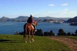 Hare Hill - Scenic Harbour Horse Trek - Horse Riding - Dunedin. Starting from NZ $85.00 per person. Hare Hill - Scenic Harbour Horse Trek - Horse Riding - Dunedin. Starting from NZ $85.00 per person. Enjoy stunning harbour views from horseback. A leisurely circuit through farmland and plantation, then back down the...
|
||||||